

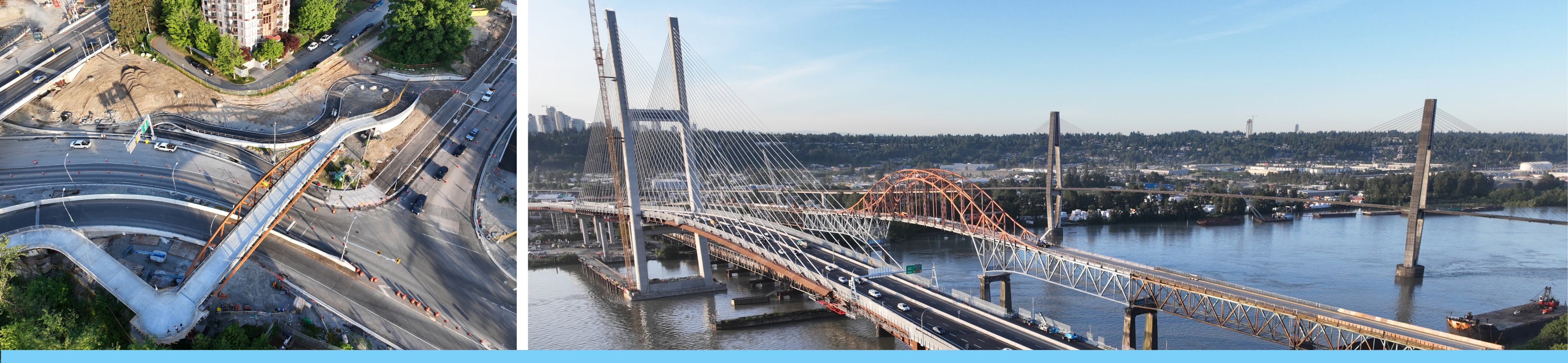
First Nations participation in the Pattullo Bridge Replacement Project began in 2016 and is continuing throughout construction of the Project
The Pattullo Bridge Replacement Project is located in an area of great past, present, and future significance to First Nations. First Nations stewardship priorities are guiding important activities on the Pattullo Bridge Replacement Project, such as cultural heritage management and fish and fish habitat offsetting.
The Pattullo Bridge Replacement Project underwent a robust harmonized environmental review process involving the British Columbia Environmental Assessment Office and the Vancouver Fraser Port Authority. The Project received its Environmental Assessment Certificate and conditions of approval in April 2019 which require an opportunity for First Nations to provide ongoing review of and input on Project management plans, permits and activities. Working together, the Project team and First Nations can ensure the prioritization and protection of environmental, archaeological and cultural values as the Project is constructed.
First Nations
As part of the environmental assessment process, and as directed by the British Columbia Environmental Assessment Office (EAO), the Pattullo Bridge Replacement Project has been undertaking consultation with First Nations. More information about the First Nations consultation process and a list of these Nations is available online at the BC EAO website. To learn more about the First Nations involved in the Pattullo Bridge Replacement Project, readers are encouraged to go directly to First Nation websites and any resources that they have recommended.
Project Area
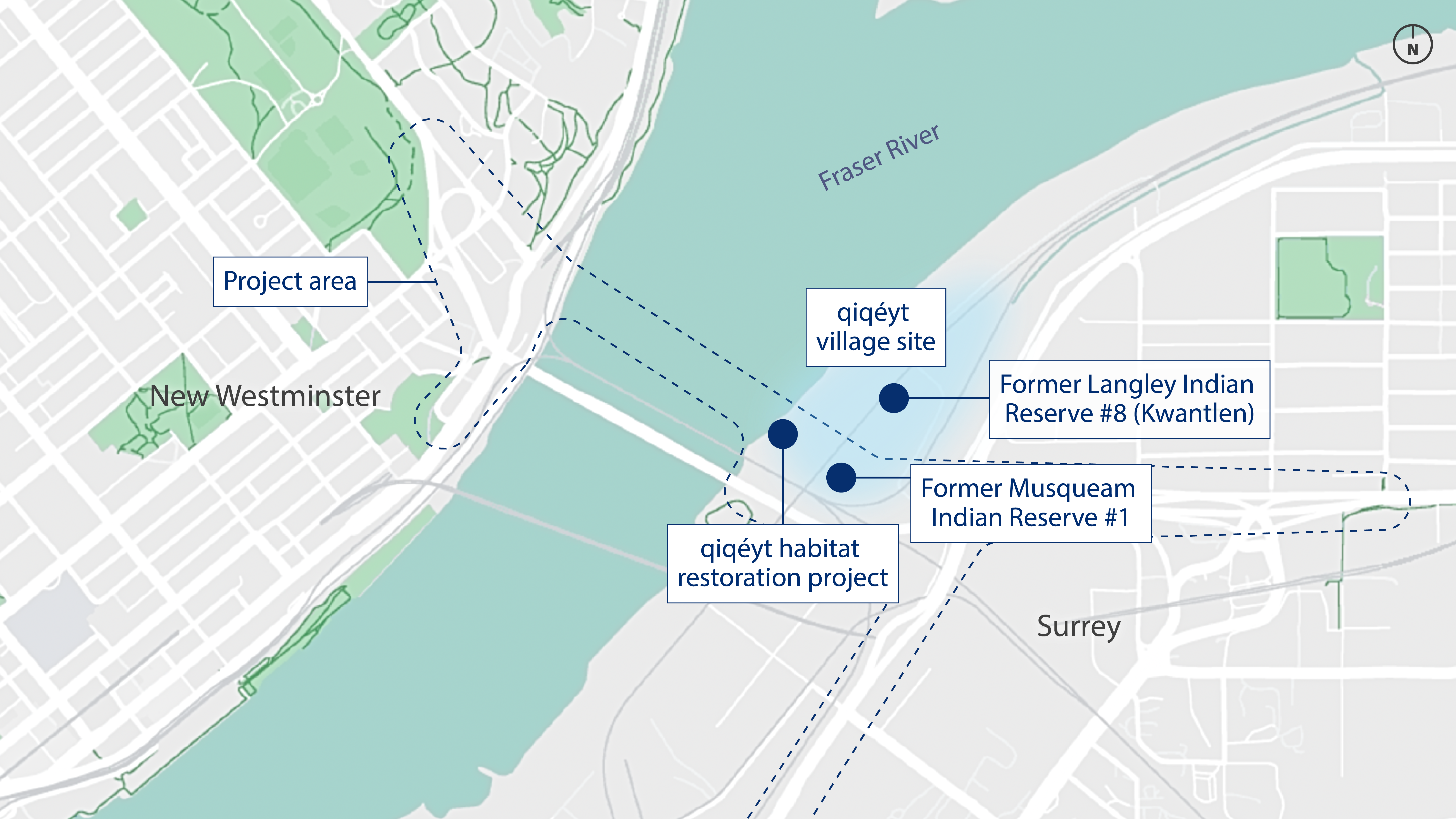
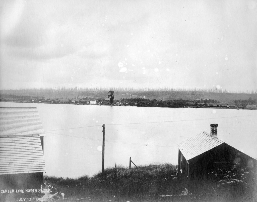
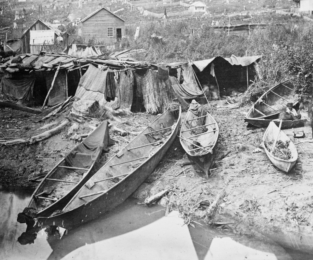
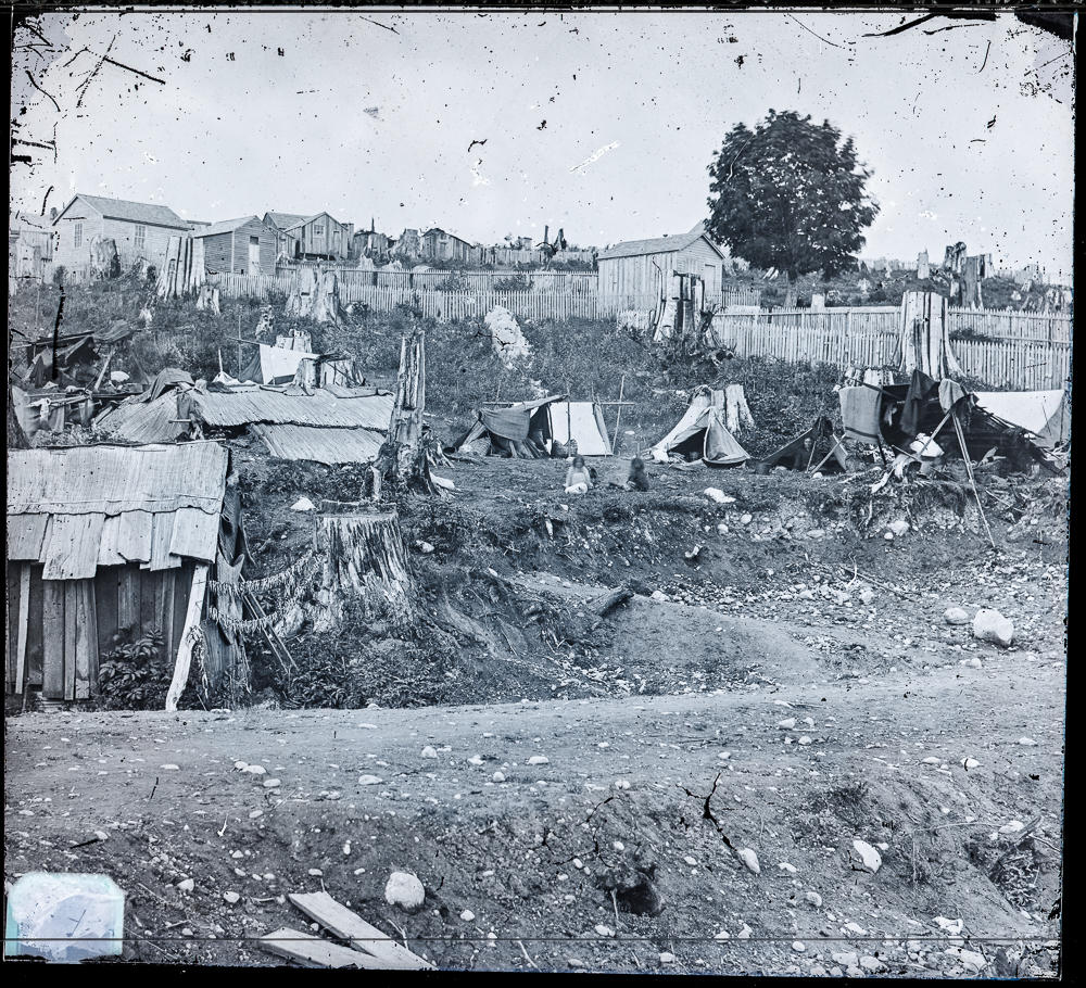
The Fraser River and its shorelines have been actively used by First Nations since time immemorial for fishing, harvesting and other important activities. The Pattullo Bridge Replacement Project site overlaps with the boundaries of two former Reserves. Former Musqueam Indian Reserve #1 and Kwantlen Indian Reserve #8 were located in qiqéyt with dispossession occurring in the 1950’s. qiqéyt was an important village site for First Nations within the Pattullo Bridge Replacement Project area in present day Surrey.
In recent history, this area has been the site of other development, infrastructure and industrial activities. The new bridge has its footprint in this important area.
Habitat Restoration and Enhancement
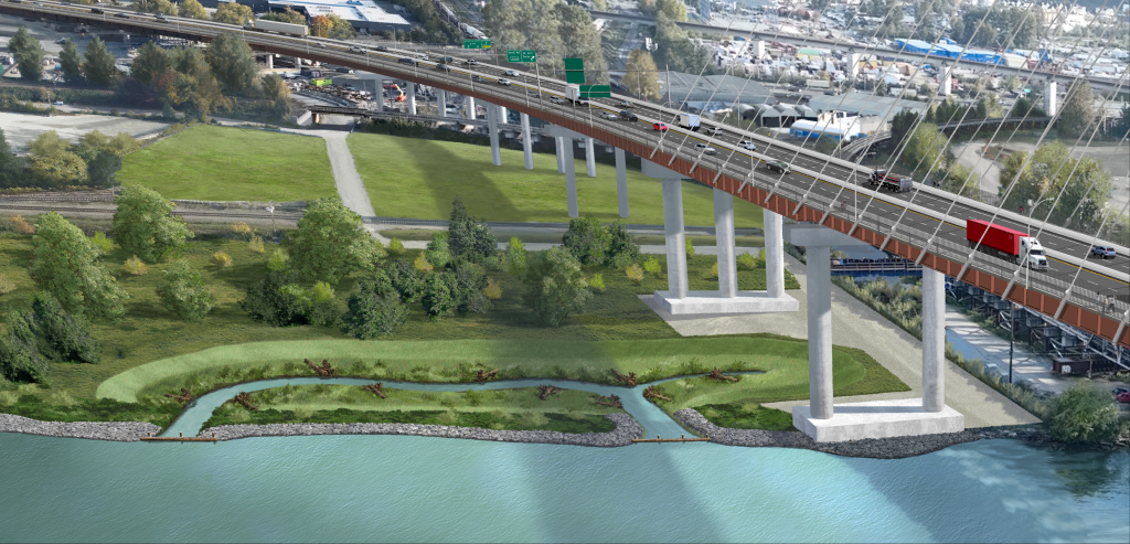
First Nations have been working collaboratively with the Province on planning related to the creation of fish and fish habitat offsetting for the Pattullo Bridge Replacement Project.
The Fisheries Act Authorization (FAA) for the Project requires the development of in-stream, marsh and riparian habitats to offset loss from the new in-river bridge piers. The new habitat selected for development will benefit species of critical importance, including five species of salmon (sockeye, coho, chum, chinook, and pink), and provide positive benefits to the broader ecosystem and other fish species.
Discussions with First Nations on site selection began in 2018 and the qiqéyt Foreshore Habitat Restoration Project, at a location slightly upstream of the new bridge on the Surrey side, has been selected. Collaborative design work is underway on this project as well as planning for a second fish and fish habitat offsetting project and First Nation-led initiative to benefit eulachon and sturgeon.
Indigenous Planting
Native riparian and marsh plant species will be a key feature of the qiqéyt Foreshore Habitat Restoration Project. Final plant selection will be guided by First Nation priorities, knowledge and input. Examples of some plants that may be included in the qiqéyt Foreshore Habitat Restoration Project planting plan are:
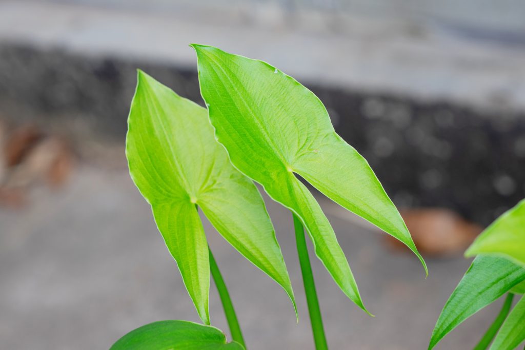
Wapato
Wapato produces starchy edible tubers.
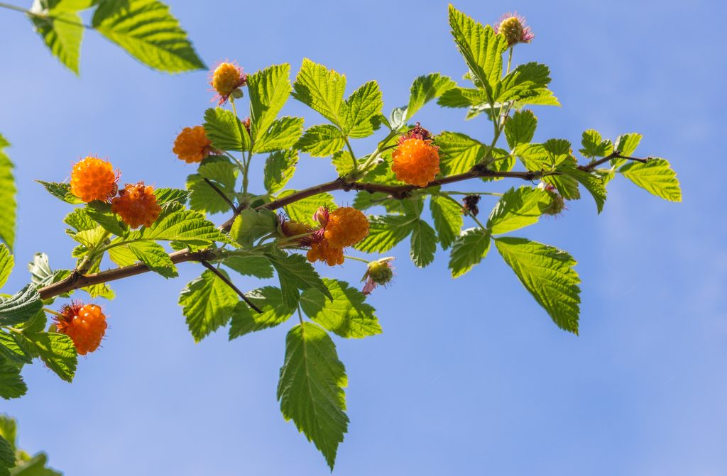
Salmonberry
Salmonberries are one of the earliest berries to ripen. The young sprouts are edible and the berries are a variety of colours.
Fish Studies in the Fraser River
In advance of project construction, and as part of the environmental assessment phase of the Project, First Nations and the Province conducted studies to learn more about two key fish species in the Project area: eulachon and white sturgeon. These fish species are of considerable cultural significance and conservation concern to First Nations.
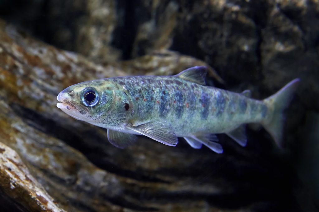
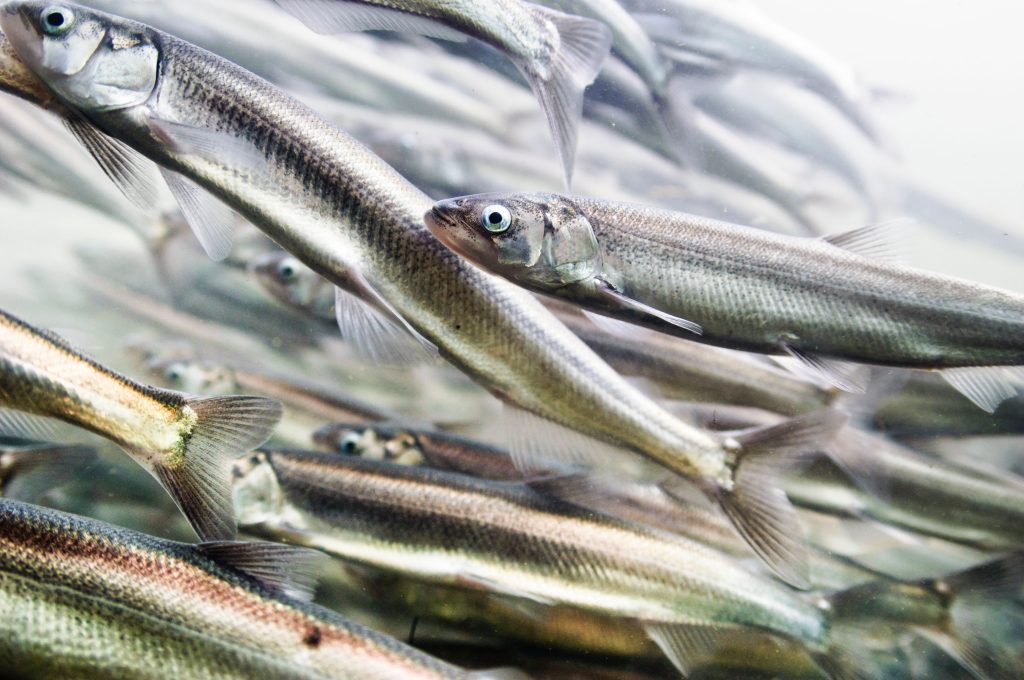
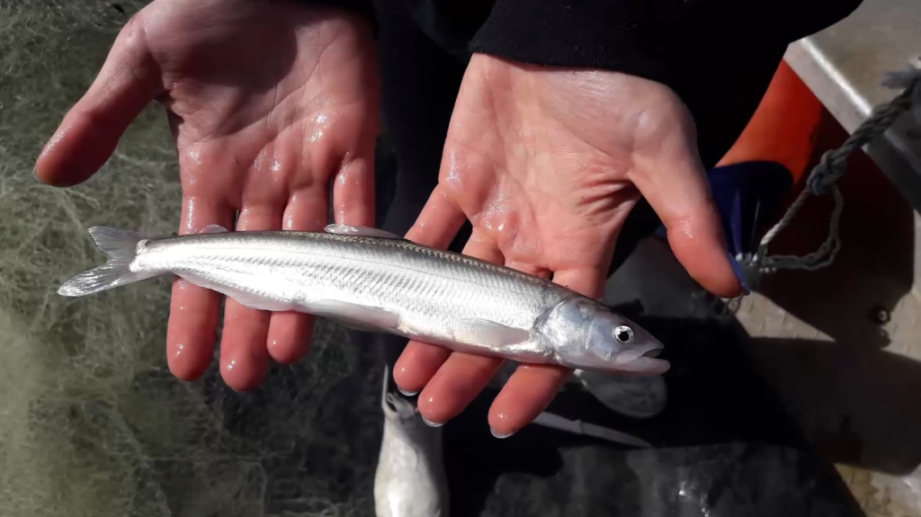
Key Species: Eulachon
“Eulachon was such an important species for us that there was a month, təm wiw̓ətən, which translates to ‘time of the eulachon’ and denotes the month/moon when the eulachon return.”
— Musqueam Indian Band
Eulachon are a small smelt-like fish that migrate up the Fraser River to spawn. Eulachon are also known as “candlefish” because they can be burned like candles when dried due to their high fat content. They are a species of critical cultural importance and are a food source for white sturgeon, another key species.
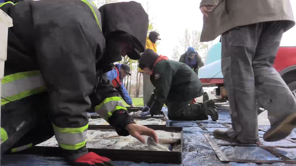
The Project’s Lower Fraser Eulachon Spawning and Staging Study (2020) was designed and executed to ensure that Traditional Knowledge and science were used to identify potential interactions between bridge construction, demolition activities and eulachon. Study design and fieldwork activities were undertaken in collaboration with First Nations.
Fieldwork included the placement of egg mats tied to buoys at selected locations on the bottom of the Fraser River. After 24 hours, the egg mats were pulled back up and brought to shore. On shore, warm water was used to remove eulachon eggs from the mats and change their colour from opaque to white, making them easier to find.
Study results are being used to inform bridge construction and demolition planning as well as habitat offsetting site construction.
“There’s not enough data on eulachon research; it’s very important that we have communities with Traditional Knowledge for use with these studies.”
— Mike Baird, Tsawwassen First Nation
“Nobody has done this in the Fraser before, it was a very interesting combination of First Nations technical skills and knowledge about where the fish are and working with the western scientists.”
— Craig Orr, Environmental Advisor, Kwikwetlem First Nation
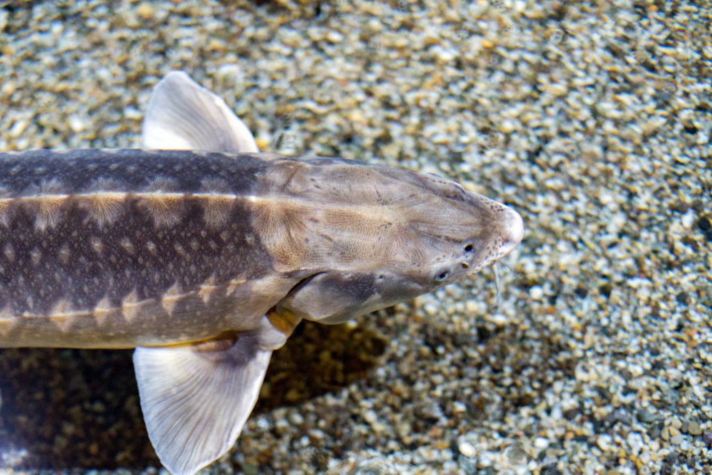
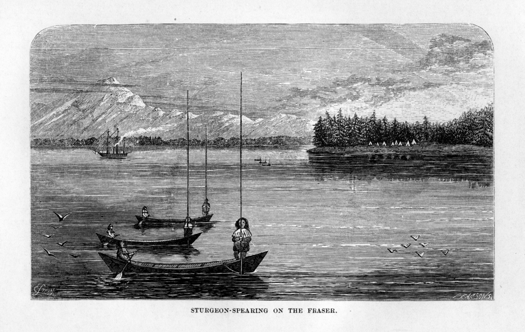
Key Species: White Sturgeon
Fraser River white sturgeon are highly valued to First Nations. Given concern about declining populations due to climate change, recreational fishing and other stressors, First Nations have not harvested white sturgeon since the early 1990s.
In response to input from First Nations, a pre-construction side-scan sonar survey was undertaken to increase understanding of sturgeon density and distribution in the vicinity of the Project area. In collaboration with the Province and LGL Limited, First Nations participated in the side-scan sonar fieldwork that resulted in the detection of 300 sturgeon ranging from 1.2 m to 1.7 m in length.
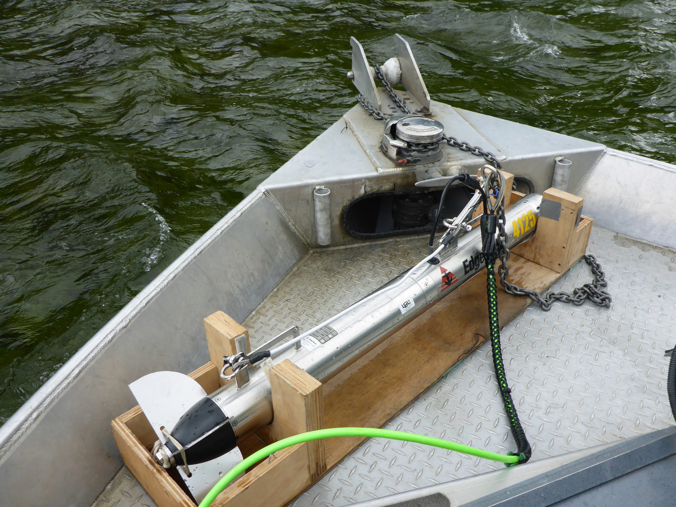
Study results are being used to inform bridge construction and demolition planning and will be used to inform habitat offsetting site construction.
For the latest Project news and updates, subscribe to our newsletter.